
At times when we experience floods, such as those currently devastating people’s homes and businesses in parts of Yorkshire, Derbyshire and Nottinghamshire, it is very common to see people attempting to distill the problem down to a single cause. In complex hydrological systems there is no sense in taking this simplistic approach; rather the whole catchment needs to be considered and we need to think about how we make entire catchments more resilient to extreme events. This is one reason for the ’i‘ in the NERC-funded Yorkshire Integrated Catchment Solutions Programme (iCASP). We work on the understanding that what happens in one area of the catchment affects other parts of the catchment because it is a whole system.
Our work looks at how processes integrate across the entire catchment and while finding solutions to environmental problems we also seek ways to address multiple problems at once, thereby delivering value for money. It isn’t just physical elements of catchment management, there’s a human element too: we work closely with partners and stakeholders on all projects to build relationships and trust and to support organisations to work together in confidence to maximise beneficial outcomes.
Flood Forecasting, and Drought & Flood Risk Mitigation are two of our six workstreams that determine the work we fund. We draw upon the research of several universities in the region including the University of Leeds, University of Sheffield and the University of York to address problems that organisations across Yorkshire are seeking to tackle. This ranges from trying to improve the ability of local councils to respond to weather forecasts by improving the advice provided in a forecast, or implementing measures that slow the flow of water across the landscape so it takes longer to move into the rivers and doesn’t contribute to sudden peak flows.
Restoring functionality
Restoring the peatland in the upper reaches of a catchment means that rainfall there takes longer to move through and into rivers downstream. Our Peatland Restoration project has developed guidance for practitioners and managers to help their decision-making as to the best restoration techniques to return the system to its normal functionality of water storage and slowing downstream flow. An added benefit of this kind of restoration is that functioning peatland acts as a sink/store locking up carbon that might otherwise be driving climate change.
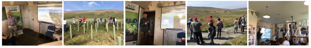
Natural Flood Management: modelling, mapping and monitoring
Several of our other projects are on the same theme as this: using natural processes to slow and store water moving through the landscape to avoid the mass flows and peaks that cause problems. There are many Natural Flood Management (NFM) pilot projects throughout Yorkshire funded by government. Our iCASP projects are supporting these by working with partner organisations to develop modelling, mapping and monitoring capability.
We use computer models to understand which parts of a catchment contribute greater quantities of water into a watercourse than other parts, and to understand the role that landscape features – both natural and human-made – may play in this process either slowing or storing water. Our modelling expertise is currently being used in our Calderdale NFM project to understand how three tributaries contribute to water flows further downstream.
Combining rainfall data and high resolution terrain data, combined with the knowledge gained from site visits means we can create ‘Opportunity Maps’ that allow an identification of what the current landscape management means for flood risk and what might be done in future.
Once developed, Opportunity Maps allow us to identify locations where NFM interventions such as tree planting, aerating soil, buffer strips or leaky dams may best be sited for maximum effect. In the case of our Don Catchment project, we work with the land managers to identify which interventions could be installed by volunteers, what interventions would be best and where our mapping allows us to identify the additional impacts these interventions may play. Many NFM interventions can serve multiple purposes; they may not only slow down the flow of water across the landscape, but they might also improve water quality or provide valuable habitat for wildlife, contributing to improved biodiversity and species richness in an area.
“We feel very privileged to have benefited from our involvement in iCASP, as it has given us access to expertise that has resulted in opportunity maps that are guiding our decision-making in relation to our Hidden Heritage Secret Stream (HHSS) project. These maps identify locations in the landscape where we can have the most impact, and they have also helped highlight the types and locations of NFM interventions that not only slow the flow of runoff, but also reduce diffuse pollution and increase ecological connectivity across the landscape. Our team is using the maps to identify sites for investigation on the ground, and they have been very useful when engaging with our partners and landowners.”
Ed Shaw, Director Don Catchment Rivers Trust
Monitoring the impact and effectiveness of NFM interventions is critical; both to being able to identify what impact is delivered, but also in being able to make the case for funding such measures and for their ongoing maintenance. A key aim of another of our Natural Flood Management projects is to improve the monitoring capability of those using NFM so they are able to carry out rigorous monitoring to contribute to the evidence base for this kind of flood risk intervention.
In our Payment for Outcomes project we are working with the National Trust to build NFM measures into their payment for outcomes trial. Farmers on some of the Trust’s tenanted farms will receive payment for the environmental outcomes they achieve, and this work will eventually inform Defra’s new Environmental Land Management Scheme and show how NFM can be integrated within this.
To maximise all the benefits of this work, we’ve developed a Natural Flood Management Community of Practice (CoP) to bring together people working on NFM to share skills, experience and best practice, build capacity and discuss challenges and opportunities. The CoP meetings draw upon the expertise we are deploying in the NFM projects we work on and also brings together people from across the region – and increasingly from beyond it too – to understand how best to manage their areas of land in the most appropriate ways for our future climate.
Improved forecasting
Slowing the flow of water through a catchment, and the measures put in place to do this are just one aspect of the measures we are working on. As demonstrated in the last week, at times rainfall is extreme and even if there are lots of interventions in place upstream, the sheer quantity of water is overwhelming, so we also work on improving flood forecasting. Our Enhanced Surface Water Flood Forecasts project worked with a range of partners to trial new forecasting software to assess whether it helped flood risk managers and emergency responders in the decision-making processes they go through in a flood event.
“In response to Defra’s Surface Water Management Action Plan, the Environment Agency and Met Office are scoping a new capability for sharing with responders very short range and rapid update forecasting (“nowcasting”) for the type of rainfall that causes surface water flooding. The Enhanced Surface Water Flood Forecasts project final report, including feedback from the incident response workshop, has provided valuable information and user response insight for the discovery phase of this project and we expect that continued engagement with the iCASP team will continue to be beneficial for understanding user needs and exploring piloting opportunities.”
Graeme Boyce, Project Executive, Flood Forecasting Centre
Our Living With Water Catchment Telemetry Integration project, which the Living with Water Partnership are undertaking in Hull, will bring together remote monitoring data of water flows carried out by several organisations with decision-making software to create a tool that will help deliver operational preparedness for events such as those we have seen in the last week and identify optimal locations for future monitoring. Combining such data collected by these organisations has not been done at this scale before; this way of joint working will be extremely powerful in making higher levels of knowledge available to decision makers and first responders about actions to take and deployment of flood defences.
Building resilience
Our newest project – Bridging the knowledge gap to boost SME resilience – starting later this month will be working on ways to build the resilience of the SME sector. Here in Yorkshire, much of the private sector is made up of SMEs who can be very vulnerable to flooding and the knock–on effects to the regional economy of a flood event can be significant and far-reaching. The project will work with local authorities and the insurance sector to develop a robust methodology for assessing the direct and indirect costs of floods on the SME sector so they are able to tailor their flood assessments and responses appropriately. By providing detailed information on the effectiveness of resilience measures and risk reduction activities, flood risk can be properly priced and managed by SMEs and appropriate support can be given to SMEs to make them more resilient and able to reduce their risks. Local Authorities will be better able to carry out future flood assessments, lobby for additional funds to better prepare for future flooding and, in the event of a flood, prioritise their response in a consistent and timely manner.
iCASP is also working with City of York Council on the Yorkshire Future Flood Resilience Pathfinder project to understand the current level of Property Flood Resilience (PFR) measures in place across Yorkshire, and what can be improved.
This just a snapshot of some of the work we are undertaking to produce solutions to water challenges across Yorkshire, the UK and globally. Our work extends right across catchments, from high and remote peatlands where some of the water that floods peoples’ homes begins its journey, to the streets where we live and the monitoring and forecasting that takes place to try to improve the way we respond, the advice given and the deployment of measures to reduce flood risk.
“Over time, we are increasing the number and diversifying the types of flood management techniques that will reduce peak flows downstream providing new tools to support farmers, villages, towns and cities susceptible to floods.”
Joe Holden, Director, iCASP
The environment is a complex system and we need to work at many different levels to tackle integrated problems. With climate change increasing the likelihood of extreme weather events, it is clear that we need to continue to invest in ways to address resilience and to use a wide range of solutions across the landscape to tackle flooding, rather than think about each component of the system in isolation.