
As part of the Natural Flood Management (NFM) work being undertaken on the Calderdale Flood Action Plan, which iCASP’s Calderdale NFM project is contributing to, three sub-catchments in Calderdale are being modelled to improve understanding of how the current land management impacts upon flooding.
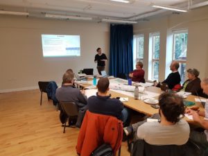
On 14 November, Tom Willis held a workshop to explore the modelling work he has been undertaking. Tom has been using SD-TOPMODEL which helps identify which areas of the 3 sub-catchments contribute most to flooding in the lower valley. Knowing which parts of a catchment contribute most to peak flows makes it easier to assess the impact of locating an NFM measure in one place rather than another, and allows prioritisation of those measures that will have the greatest benefits.
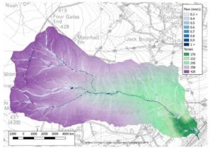
Having seen how the model works, workshop participants could apply their knowledge and insight of the catchment into devising different scenarios for the next on-the-ground stage of the project. They then live-tested them during the session to see their impact upon peak flood levels
The next steps in this project will be the creation of a handbook to assist landowners and managers in targeting the most appropriate NFM measures across the catchment.