
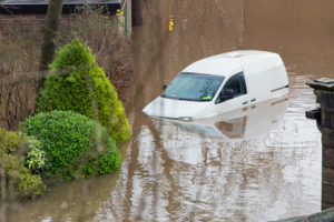
 Yorkshire is prone to all sources of inland flooding: from rivers, rising groundwater, flash floods and prolonged heavy rainfall which can cause surface water flooding. Arguably flooding from rivers is more straightforward to forecast because rises in water level can be measured and seen in advance. However, in the case of rainfall, it is harder to forecast precisely where heavy prolonged rain is going to fall and therefore if that rainfall will cause surface water flooding by landing somewhere with inadequate drainage.
Up until now surface water flood forecasts have been limited to relatively coarse–scale county-level red/amber/green warnings issued by the Flood Forecasting Centre and static risk maps, which are more useful for longer term planning. The iCASP Enhanced Surface Water Flood Forecasting Project will therefore convert the latest advances in probabilistic rainfall forecasting and high-resolution surface water modelling into useful real-time forecasts to help authorities which have to react to potential flood events.