Prioritising Natural Flood Management interventions in Calderdale

Photo Courtesy: Slow the Flow

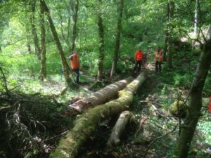
A rainfall-runoff model developed at the University of Leeds is the latest weapon in Calderdale’s efforts to prevent future flooding in the valley. SD-TOPMODEL is currently the only tool able to model the flow of water from hillslopes to the river at a sufficient spatial scale to allow Natural Flood Management (NFM) interventions and land management to be represented accurately for the characteristics of the Calderdale catchment.

An iCASP project using SD-TOPMODEL and starting in November 2018 will contribute to the Calderdale Flood Action Plan by helping to prioritise the siting of future NFM schemes.

Read more

UKCP18 Regional Forum

The UKCP18 Regional User Forum will use the release of the updated UK Climate Projections 18 as an opportunity to bring together different sectors of the regional economy to ensure that the latest knowledge is embedded in catchment management decisions. The afternoon event in Leeds on March 8th 2019 will be designed for organisations who need to use UK climate projections for resilience planning and long-term business strategies.

IF INTERESTED, Quick email to:  icasp@leeds.ac.uk


Read more

Better land management for a multifunctional landscape

Credit: DCRT

The latest iCASP Project will help advise the Don Catchment Rivers Trust on their Hidden Heritage Secret Streams project. This is based on the Upper Rother Catchment, a tributary of the River Don. One of the aims of the project is to improve the way land is managed so that it provides both social and heritage benefits.

Volunteers will be recruited to put in place small and simple changes to reduce river pollution from different sources, slow the rate at which water flows down the river, and make it easier for different species to flourish by ensuring suitable habitats are connected up in the landscape.

At the moment, it’s difficult to prioritise what should be done because there isn’t enough available information on the different options and whether they can be carried out by volunteers. This is where iCASP can add most value.

Read more

Bricks and Water

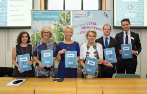
A new report, Bricks and Water, which iCASP helped to inform, has been published by the Westminster Sustainable Business Forum, an off shoot of Policy Connect.

It sets out an action plan for better management of water to deliver water-efficient homes at volume, that are resilient to flooding and calls for a ‘Bricks and Water’ sustainability code with a change in building regulations to provide a stable long-term planning framework.

Read more

Eyeing up our rivers

Photo courtesy: Sheila Palmer, University of Leeds

The latest iCASP Project, The Derwent Data Finder, will  explore whether a collaborative monitoring system could help the Environment Agency to reduce costs and to gather more information. The Environment Agency currently spends 60 million pounds a year gathering information on the state of the water environment to meet regulatory requirements.

However, many other organisations, including iCASP partners and universities, also collect relevant data which if shared might fill existing knowledge gaps and prevent duplication.

Read more

Spring call for new projects

iCASP is once again inviting expressions of interest for iCASP projects.

If you have an idea please complete the 6 page Expression of Interest (EOI) document that you can download from the link below.

Read more

Managing land more beneficially

Photo Credit: Les Firbank

Leaving the EU gives the UK an opportunity to rethink farm subsidies. The government is currently exploring how to incentivise farmers and land owners to improve water quality, soil health  and flood protection. This is where iCASP can help. The Agri-Land Management for Public Goods Delivery Project is going to review and consolidate the evidence on land management interventions which generate a wide range of public goods.

The Review will focus on a selection of land management activities currently undertaken in the River Ouse drainage basin area of Yorkshire, including those supported through Countryside Stewardship.

Read more

Looking into nitrate pollution

Water companies spend millions of pounds a year removing harmful nitrates from drinking water and the problem seems to be getting worse. Most of this pollution relates to agriculture, so various incentive schemes to stop nitrates getting in to water have been trialled with farmers. However, the effectiveness of such schemes and the resultant reduction … Read more

Peatlands Vital for UK Water Security

Research co-authored by iCASP Director, Professor Joe Holden shows how dependent the UK is on peatlands to supply drinking water. The study published in Nature Sustainability this week is based on a new global index developed by a group of scientists from water@leeds which estimates that 72.5% of the storage capacity of UK water supply … Read more

Enhanced Surface Water Flood Forecasting Project

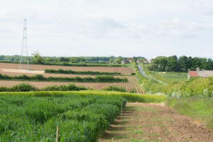
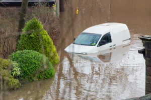
Yorkshire is prone to all sources of inland flooding: from rivers, rising groundwater, flash floods and prolonged heavy rainfall which can cause surface water flooding. Arguably flooding from rivers is more straightforward to forecast because rises in water level can be measured and seen in advance. However, in the case of rainfall, it is harder to forecast precisely where heavy prolonged rain is going to fall and therefore if that rainfall will cause surface water flooding by landing somewhere with inadequate drainage.

Up until now surface water flood forecasts have been limited to relatively coarse–scale county-level red/amber/green warnings issued by the Flood Forecasting Centre and static risk maps, which are more useful for longer term planning. The iCASP Enhanced Surface Water Flood Forecasting Project will therefore convert the latest advances in probabilistic rainfall forecasting and high-resolution surface water modelling into useful real-time forecasts to help authorities which have to react to potential flood events.

Read more