A manual to help landowners and farmers introduce the best possible natural flood management measures on their land and get an appropriate level of funding for doing so has just been published.
It has been developed as part of a large-scale conservation project based around the River Skell, to encourage landowners to implement nature based solutions (NBS) to reduce flood risk and sediment erosion at Fountains Abbey and Studley Royal, a World Heritage Site managed by the National Trust.
Background
The Skell Valley Project started about five years ago, when local groups and individuals came together to look at opportunities to care for the North Yorkshire river valley. The Partnership is led by the National Trust and Nidderdale National Landscapes who work with various stakeholders and funders, and they have 15 individual projects including work with University of Leeds researchers to make the catchment more resilient to flooding and sediment erosion.
Previous extreme weather and flooding events in the Nidderdale AONB has resulted in damage to high profile sites such as Fountains Abbey and Studley Royal. The high levels of sediment deposited from the River Skell is threatening the local ecology and contributing to a reduction in water quality. As climate change increases extreme weather and flooding, understanding water flow has become crucial. During 2015 – 16, storms in the UK caused £1.6 billion in damage.
Healthy Lands, Healthy Rivers
A report – Healthy Lands, Healthy Rivers – has been produced by University of Leeds researchers to understand how natural flood management (NFM) interventions, like leaky dams, are impacting the amount of sediment in the river and its flow levels.
These data informed a Payments by Results (PbR) manual, produced by the group of academics including Dr Stephanie Bond, Ms Helena Brown, Dr Megan Klaar, Prof David Hodgson, Dr Gareth Keevil and Ms Farhana Naz, which has been designed for farm advisors or park rangers to develop PbR plans for a farm or land, in consultation with a landowner.
Co-developed plans for capital interventions and changes in land management approaches that provide financial incentives for farms, supporting them to be sustainable enterprises, as well as reducing flooding downstream over many subsequent years.
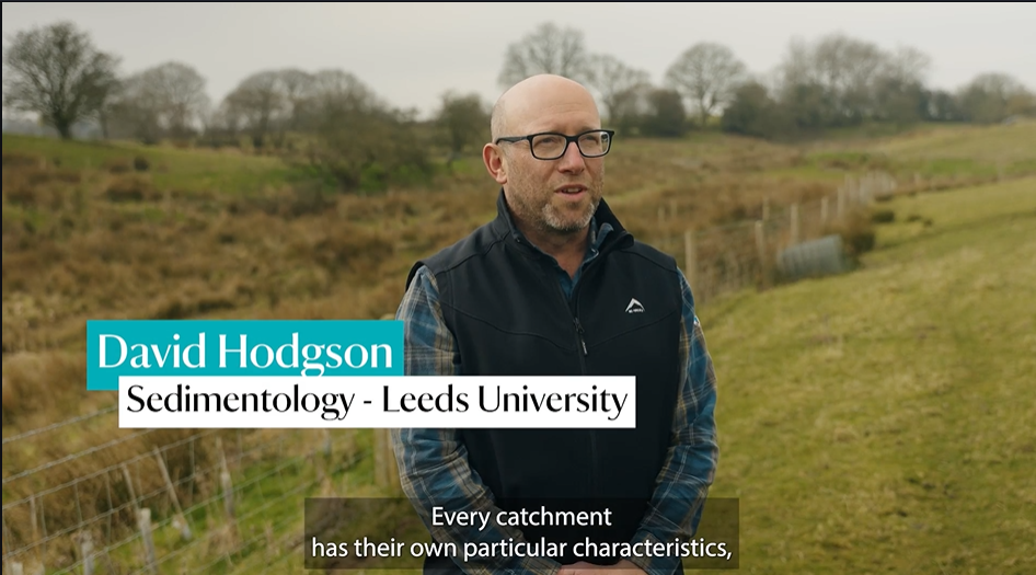
The main challenge was to create a framework that could easily be put into practice and yet still takes into account the complexity of natural systems, a range of NFM interventions, varied land use practices and the restrictions of different funding schemes. David Hodgson, Professor of Sedimentology and Stratigraphy at University of Leeds,
Every drainage catchment is different, and so the interplay of a range of factors need to be considered, including the relative importance of reducing flooding, improving ecosystems, and modifying sedimentation and erosion patterns.
Although this manual was designed primarily to mitigate flooding and sediment transfer, the framework can be readily adaptable to a wider range of Nature Based Solutions.”
The manual highlights both payments for short-term capital interventions that might have rapid impacts in just a few years and land management changes where the benefits would be evident over a much longer period.
It takes into account technological expertise and return period. The manual also covers the type and duration of monitoring, both before and during the lifespan of different interventions, to demonstrate the environmental benefits of the NBS installations and changes in practices.
“A major motivation for landowners to engage in PbR schemes is financial benefits. These schemes are underpinned by economic incentives to install and maintain interventions and to trial new land management practices. NBS can help reduce the use of fertilizer, reduce soil loss, improve river and floodplain habitats, and maintain and increase productive land through better drainage and less erosion,” said Dr Stephanie Bond, Impact Translation Fellow with Yorkshire Integrated Catchment Solutions Programme iCASP
“Linking farm-scale NBS interventions to catchment-scale changes in flooding and sediment load is very challenging to demonstrate quantitatively. This might be possible through long-term monitoring before and after installation.
“Even if quantification proves difficult, it is important to allow the staged release of payments to landowners over different timescales.”
The Payment by Results manual illustrates the steps that an advisor or ranger will take in consultation with a farmer or landowner. It includes information about the wide range of different NFM interventions and land management practices open to a typical landowner, the assessment phase prior to any interventions and opportunity mapping, the calculation of NFM payments and addresses the crucial aspect of monitoring, which is becoming part of many funding schemes.
A highly collaborative approach was needed to produce the practical manual which involved workshops with the Yorkshire Natural Flood Management Community of Practice, farming community, including landholders and farm advisors, and Nature Base Solutions and Payment by Results experts. There were also regular meetings between teams from iCASP, the National Trust and the Nidderdale National Landscape. Consultation with users of existing similar PbR schemes and likely managers of the future payment by results scheme in the Skell Valley also took place.
Learning was also incorporated from a previous iCASP, National Trust and Nidderdale National Landscape (then Nidderdale AONB) project in the Skell Valley, which mapped the risk of overland flow and sediment erosion for the Laver catchment using open-source software (SCIMAP). Scientific and non-technical literature was also examined to find transferrable examples of the PbR approach.
The Skell River is classed as a flashy catchment which means it rises rapidly during heavy rain. The emphasis of the Skell Valley Project was on reducing river levels and sediment load during flood periods at a catchment scale – through Fountains Abbey and Studley Royal, as well as in the city of Ripon. This informed the relative importance of benefits arising from the PbR scheme. A similar physiography and issues are shared by many of the land holdings in the catchment, which were used to develop opportunity maps with landholders. However, at a farm-scale there are important differences. For example, aspect, topography, land use and connectivity to the River Skell, which meant each farm required separate assessment and ground truthing proved essential.