
A successful workshop exploring opportunities for natural flood management (NFM) in the Moss Brook catchment was held in Eckington, southeast of Sheffield, as a joint venture between iCASP and the Don Catchment Rivers Trust (DCRT)
This was the first workshop, organised in late October, as part of our Upper Rother Project, which focuses on three sub-catchments in the Upper Rother Catchment. The project aims to create a directory of NFM evidence which will help the DCRT to target areas that have the greatest impact on reducing flood risk. Future workshops will be held focusing on the River Hipper and Spital Brook catchments.
SD-TOPMODEL, a rainfall-runoff model, is being used by iCASP during this project, which is capable of modelling the overland and subsurface flow associated with storm rainfall through a catchment. It can be modified to represent different land uses and NFM interventions. This model excels when assessing changes in land management, it allows a detailed look at how water behaves within catchments and can identify the most effective sites to place NFM interventions.
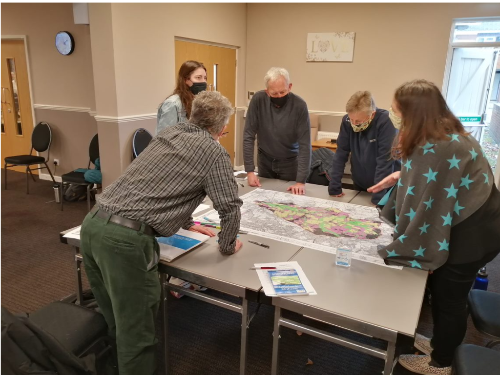
The workshop was an interactive event as stakeholders who work on the ground had the opportunity to study maps of Moss Brook and update them with their vital local knowledge.
Aims of the event
These were twofold – to verify initial outputs from the modelling with stakeholders that work in the catchment and to prioritise which interventions should be modelled. Stakeholders were asked to share their knowledge about areas of the catchment they had seen flood and verify flow pathways (for example, they were asked have you seen water flow across your land at specific locations?) and land-use maps (for example, they were asked if they had any further information on how they managed their land?). Also stakeholders were also asked to prioritise which NFM interventions they would like to see modelled and identify areas in the catchment where they could be placed.
Information from the stakeholders will be used to refine baseline models and run scenarios looking at different NFM interventions. The models will quantify the impacts of the different interventions on reducing flooding (for example, delay to peak, and decrease in peak volume). This information is vital to support grant applications and will be the main outcome of the project for the three sub-catchments.
Representatives taking part in the workshop were from the following organisations: Sheffield and Rotherham Wildlife Trust, Twelve Acre Wood, Newfield Spring Wood, Moss Valley Wildlife Group, Derbyshire County Council, Natural England, Environment Agency and University of Leeds.
Dr Debbie Coldwell, NFM Officer for the Don Catchment Rivers Trust, said:
“This workshop was incredibly valuable for bringing together stakeholders from the Moss Valley, building connections and capturing vital local knowledge and understanding of the catchment.
“There were lots of lively conversations and lots of scribbling on maps that will be so important in developing the models and determining the different NFM interventions to be incorporated and quantified.
“Working with ICASP on this project will allow us to take a much more strategic approach to NFM in this area and we hope to use the outputs to support key landowners in delivering NFM that will have a meaningful impact on reducing downstream flood risk.
Dr Janet Richardson, iCASP Impact Translation Fellow, said:
“This workshop was vital to understanding the Moss Brook catchment in more detail. We will be able to integrate the stakeholder knowledge into our modelling which will ensure the model runs in a way that is more true to life and represents on the ground conditions. This project will be able to help prioritise areas within the catchment that are the most effective at reducing flood risk and we will model interventions chosen by the attendees at the workshop.”
The next steps of the project are:
- Information from the workshop will be digitised and integrated into SD-TOPMODEL
- NFM interventions will be modelled and their impact on the flood curve quantified
- The same process will be applied to River Hipper and Spital Brook catchments.
- Outputs will be available on our website.
If you have an interest in or local knowledge about these catchments, please do get in touch with us by email as we will be holding further workshops in Spring 2022