
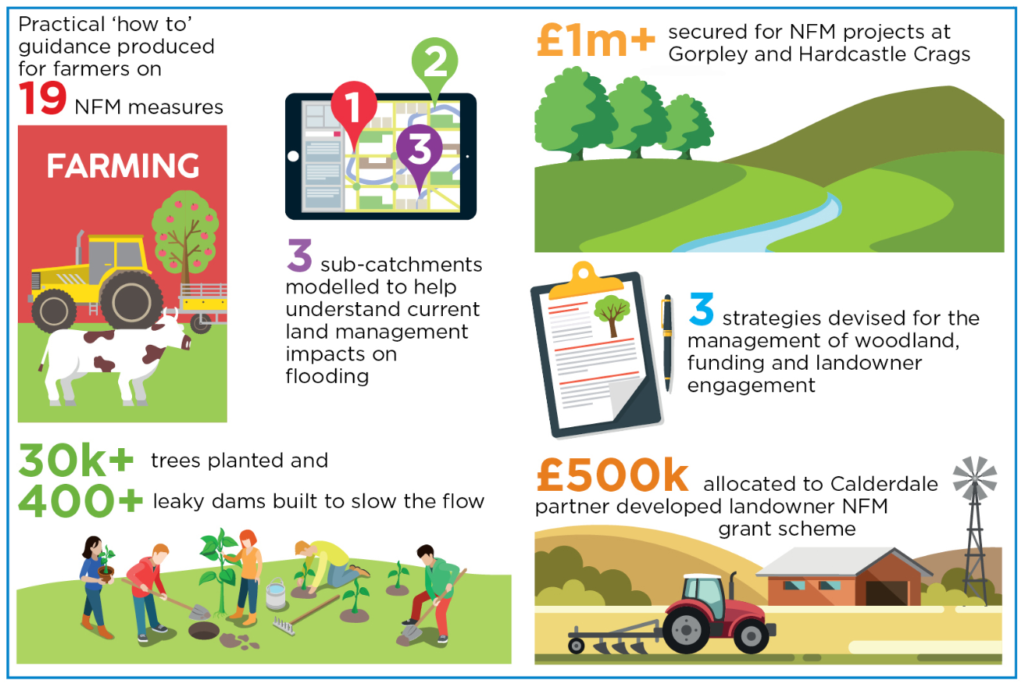
This October is the 3rd anniversary of the Calderdale Flood Action Plan (FAP) . You can find out more about who is involved with delivering the plan, the various pieces of work being undertaken and get an idea of the costs and the benefits of work already carried out through infographics produced to highlight key actions and work so far
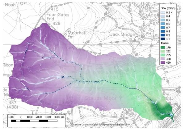
iCASP academics have been involved with work in Calderdale that aims to reduce the flow of water through the catchment using Natural Flood Management (NFM) measures. The iCASP project has been using a rain-fall run-off model, SD-TOPMODEL, to help with identifying which areas of 3 sub-catchments of the Upper Calder River contribute most to peak flows. Understanding which parts of a catchment are contributing most to flooding in the lower valley make it easier to assess the impact of locating an NFM measure in one place rather than another and allow prioritisation of those measures that will have greatest benefits.
The model produces maps like the one below that shows the speed at which water is flowing and uses rainfall data from nearby weather stations and high resolution terrain data. This modelling is combined with on-the-ground visits and meetings with landowners, land managers and flood risk managers to get the fullest picture of what is going on across the landscape when it rains.
The modelling and site visits improve understanding of what contributions existing landscape features already make; for example hedges and walls can help slow the flow of water across the land and by acting as a temporary store help reduce the peak flows of water. These aspects can then be included to further improve the representation of these features in the model. The modelling and site visits also allow experts to identify where in the landscape new NFM features can be located to further slow and store water.
At a meeting in November the modelling results will be presented to all the partners working on flood measures in Calderdale. From these results a handbook will be created to assist land owners in targeting appropriate NFM interventions, and to further understand how the whole catchment responds during flood events.